Driving south down Airport Way, you eventually reach the end of the pavement and the start of hundreds of kilometres of dirt road. If you keep going, you'll eventually come to a fork in the road – right leads to the flats at 12 Mile and left takes you down the Alkokolex Forest Service Road. Keep going, past Echo Lake, and eventually you'll want to hang a sharp right, across a creek; going straight will take you deep down the Alkokolex River valley.
Keep going, past the roaring Alkolkolex Falls, with its hiking trail that leads right down to the Columbia River, and over the bridge across the river. A little bit further along you'll come to a three-way fork. Turn left and you'll eventually be at Mt. McCrae hiking trail, which in about an hour brings you to a campsite next to an alpine lake, with alpine meadows just up the hill. Go straight, and the road winds through the some cut blocks and ends on the south flank of Mt. McCrae.
Turn right, and the road keeps heading south. For another 20 kilometres it winds through cut blocks that offer views across the Columbia River, which in the summer, when the reservoir is high, is turned into part of the Upper Arrow Lake.
Eventually, about 50 kilometres after you leave the pavement, the road begins to switchback up Mount Sproat. Soon enough, you'll come to a fork in the road – the left fork takes you to a hiking trail and the right fork brings you to an ATV trail. They are the two ways to get to the summit of Mount Sproat and the fire lookout that sits up there, empty, but still maintained.
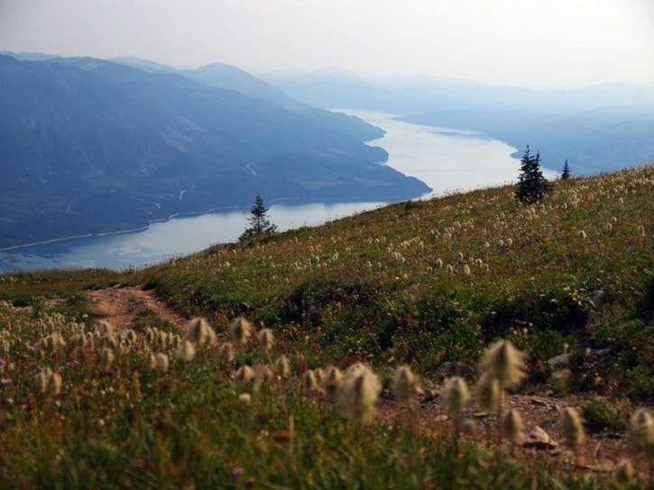
The hiking trail to the top of Mount Sproat is steep and short – it climbs about 850 metres in four kilometres. After spending most of its time in the forest, it emerges into beautiful alpine, with views up and down the Upper Arrow Lake, the Beaton Arm, the Incommapleux Valley and across to the Gold Range of the Monashees.
The ATV travel first heads south and then turns east across the southern flank of the mountain, traversing across numerous avalanche paths before creating on top of a ridge, which it follows to the fire lookout.
The trail was built in 1939 and originally started in Arrowhead, a historic community on the shores of the Columbia River. According to the Ministry of Forests, the lookout wasn't built until 1949 when a pre-fabricated building was erected; before then forest rangers would live in a tent while working up there. In 1955 the existing fire lookout was flown to the summit and erected there. In 1964, the current ATV road was built to make access to the summit easier.
When Arrowhead was abandoned due to the flooding of the reservoir, the trail and the road were largely lost too. That changed when the forest road was extended to the area and the Revelstoke ATV Club started maintaining the old road and lookout in 2003.
One day last summer, I pushed my bike up the ATV road. The first few hundred metres were very steep, before the trail leveled out and rolled along for the next two kilometres. Then it started going up and I pushed and pedaled through avalanche paths until cresting the ridge. From there, the road was lined by wildflowers as it wound its way to the lookout. As I pushed, I could hear a pair of dirt bikers coming up the trail behind me. After arriving at the lookout, which was clean and in great shape thanks to the ATV club, a family of ATVers showed up. I can’t think of many other trails that allow four different ways to the top.
It was a hazy day, but the views were vast and amazing. The ridge to the actual summit of Mount Sproat beckoned and it seemed possible to hike for kilometres through the alpine. Instead, I turned around and made the fast descent back to my car and the road home, back north.