Forecast from Environment Canada:
Snowfall warning up to 20 cm expected by Wednesday morning
Today: Cloudy with 40 percent chance of flurries or rain showers. Wind north 20 km/h gusting to 50. High plus 3. UV index 2 or low.
Tonight: Cloudy with 40 percent chance of flurries this evening. Clearing overnight. Fog patches developing overnight. Wind north 20 km/h becoming light this evening. Low minus 4.
Tomorrow: A mix of sun and cloud. 60 percent chance of flurries late in the morning and in the afternoon. Fog patches dissipating in the morning. High plus 5. UV index 3 or moderate.
For more information see Environment Canada.
Construction and road conditions from DriveBC @ 7:30 am:
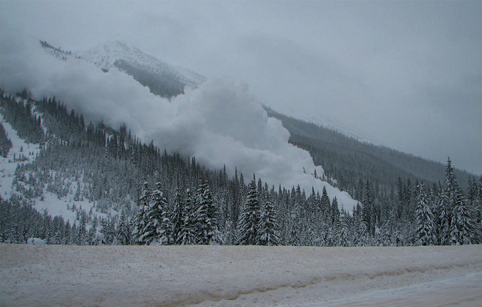
Highway 1
East to Golden: Avalanche control near Rogers Pass until 3:00 p.m PDT. Expect individual closures for up to two hours.
West to Sicamous: Limited visibility with snow. Slippery sections.
Highway 23
North: Slippery sections.
South: Slippery sections.
For more information see DriveBC.
Revelstoke Mountain Resort Snow Report @ 7:30 am:
New snow: 11 cm
Base depth: 277 cm
Season total: 983 cm
Temp on top of the Ripper: -8C
Insta
Avalanche Report from Parks Canada for Glacier National Park:
Issued Wednesday
“Presently we are in a natural avalanche cycle. This will taper off throughout the day but the snowpack will take some time to adjust to the new load. Expect storm slabs to be reactive to human loads.”
Alpine: Considerable
Treeline: Considerable
Below treeline: Considerable
For more information visit Parks Canada
Avalanche Report from Avalanche Canada for South Columbias:
Issued Wednesday
“New snow overnight will increase storm snow totals to 25-45 cm. Strong westerly wind will build slabs which will be reactive to human triggering especially in lee terrain features. A buried weak layer warrants a conservative mindset and terrain use strategy.”
Alpine: High
Treeline: Considerable
Below treeline: Considerable
For more information visit Avalanche Canada
Avalanche Report from Avalanche Canada for North Columbias:
Issued Tuesday
“New snow overnight will increase storm snow totals to 20-40 cm by Wednesday morning. Strong westerly wind will build slabs which will be reactive to human triggering especially in lee terrain features. A buried weak layer warrants a conservative mindset and terrain use strategy.”
Alpine: Considerable
Treeline: Considerable
Below treeline: Considerable
For more information visit Avalanche Canada