Forecast from Environment Canada:
Winter storm watch in effect for Revelstoke
A Pacific frontal system will spread significant moisture across the Columbia and Elk Valley regions on Tuesday. Consequently, snow will become heavy at times in the morning and last through Tuesday night. At this time accumulations are expected to reach 25 cm over a 24 hour period. The snow is forecast to end Wednesday morning.
Today: Cloudy with 60 percent chance of flurries. High plus 1.
Tonight: Periods of snow. Amount 2 to 4 cm. Temperature steady near minus 1.
Tomorrow: Snow at times heavy. Amount possibly reaching 15 cm. Temperature steady near zero.
For more information see Environment Canada.
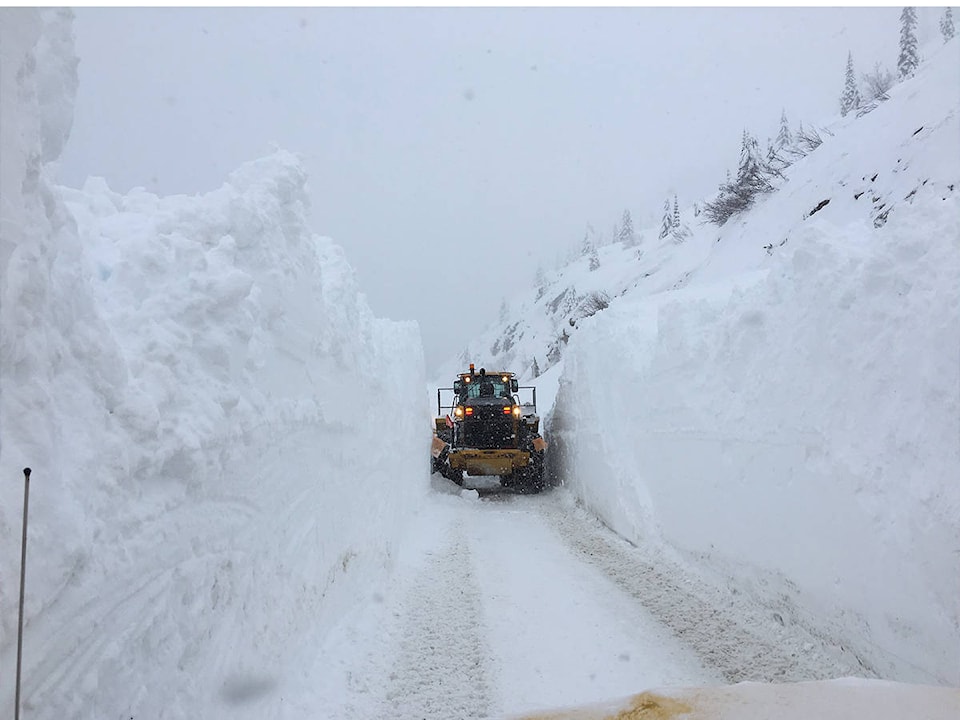
Construction and road conditions from DriveBC @ 8:00 am:
Highway 1
East to Golden: Avalanche control planned from 11 a.m. to noon. Road will be closed between Illecillewaet Brake Check and Hemlock Grove Boardwalk for 8.4 km.
West to Sicamous: Black ice.
Highway 23
North: Slippery sections.
South: Slippery sections. Compact snow.
For more information see DriveBC.
Revelstoke Mountain Resort Snow Report @ 8:00 am:
New snow: 8 cm
Base depth: 209 cm
Season total: 567 cm
Temp on top of the Ripper: -10C
Avalanche Report from Parks Canada for Glacier National Park:
Issued Saturday
“Assess, assess, assess! Expect reactive slabs! Extreme south winds have created a variable upper snowpack.”
Alpine: Considerable
Treeline: Considerable
Below treeline: Moderate
For more information visit Parks Canada