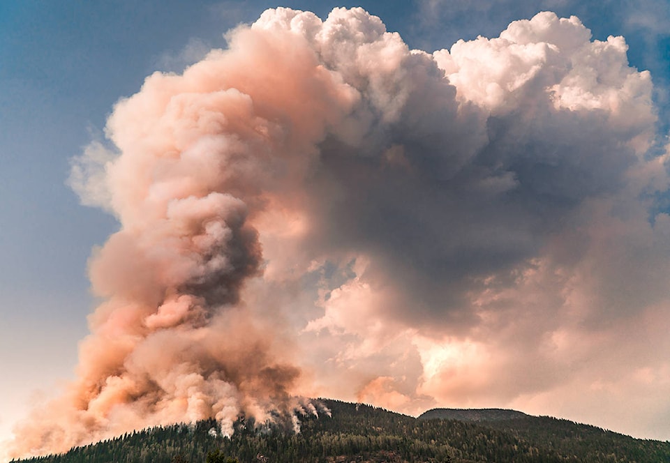
A number of wildfires continue to burn in the Revelstoke area though none are currently a threat to the city or any surrounding properties.
In Mt. Revelstoke National Park the Clachnacudainn Creek East wildfire, near the park’s West Welcome, is approximately 200 hectares in size, said a news release from Shelley Bird, information officer for the parks.
In Glacier National Park a new wildfire was detected on the southern end of the Beaver Valley in the national park.
The fires is approximately 30 hectares in size and is in the backcountry, well away from roads, buildings and people.
The wildfires do not currently pose a risk to people or assets, said the release.
There is now a fire ban in Mt. Revelstoke, Glacier, Yoho, Kootenay and Banff.
According to the BC Wildfire Services Active Wildfires map the fire on Mt. Begbie is 0.30 hectares. The suspected cause is a lightning strike and it was discovered July 31.
Nearby there is also a fire at Mulvehill West that was discovered on Aug. 2 with an estimated size of 0.01 hectares.
A fire north of Mt. English is said to be 48 hectares in size. It was discovered Aug. 3 and the suspected cause is lighting.
Nearby, with an approximate location of Upper Eagle River, is a 0.01 hectare fire that was also caused by lightning and discovered on Aug. 1.
Another fire discovered on Aug. 1, also west of Revelstoke, near South Pass Creek, is less than 0.01 hectare in size.
The fire discovered on July 31 near Three Valley Gap remains at 0.01 hectares.
On the west slop of Mt. English, a fire was discovered on Aug. 1, and it 0.01 hectares.
On Aug. 6 the Wildfire Service found another fire near the Victor Forest Service Road. The size is reported to be 0.01 hectares and the suspected cause is lightning.
Nearby, with an approximate location of Wap Creek, is another fire that is around 0.01 hectares in size.
Southeast of Revelstoke there is a fire near Akolkolex that is 0.01 hectares. Nearby, with an approximate location of McCrae Trail is a fire that is less than 0.01 hectares in size, also caused by lightning.
On McCrae Main, a fire of 0.09 hectares in size was discovered Aug. 1, suspected to be caused by lighting.
Eight fires continue to burn north of Revelstoke. Seven on the east side of the river and one on the west side.
The fire near Frisby Ridge, on the east side of the river, is 0.5 hectares, and the largest fire burning in that area is the Roseberry Mt. West Aspect fire at 2.1 hectares.