You may not realize how widespread Revelstoke's trail network is. From the Jordan River to the Big Eddy, from CPR Hill to Williamson's Lake, there's trails all over the community. Some are wide and well maintained, others are scratched into the ground.
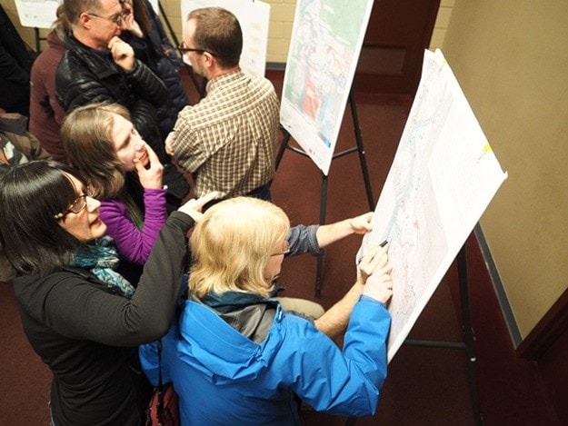
On Monday, the Macpherson Room at the community centre was packed for two hours as people came to look at the initial work completed for the new City of Revelstoke trail strategy and provide feedback.
They saw maps showcasing the sheer number of trails in the Revelstoke area and got to provide input on their own priorities for the trail network.
"We added 422 kilometres of trail and we had had 150 kilometres before that," said Fraser Blyth, the consultant who was contracted to develop the strategy. "It’s been nice to learn where all these areas are. I hope when we put the inventory out there’s trails people didn’t know about before that they’ll go and explore.
The project was launched in September with stakeholder meetings. Data was collected from web sources like Open Street Maps and Strava and combined with local knowledge to develop an extensive map of the trail networks in the area.
They mapped as many trails as they could, from well-used ones like the Greenbelt and CPR Hill trails to the less known ones along the Jordan River off Westside Road. They also included trails outside city limits like the Mt. Macpherson network and the Mount Revelstoke National Park trails.
"We built an inventory of existing trails, then we added on to that," said Laurie Donato, the city's director of parks, recreation & culture.
Using data from Strava, they determined the Greenbelt trails and the one leading to Mount Revelstoke National Park were the most popular. They also discovered the most popular commuter route was from Airport Way, up Fourth Street, Third Street, Douglas Street and over to the Big Eddy.
Trails were divided into six classes ranging from paved trails to maintained single track to informal trails.

Photo: A cyclist rides a trail on CPR Hill. One of the proposed initiatives is to formalize the network there, which would involve negotiations with private landowners. ~ Revelstoke Review file photo
The stakeholders came up with a list of strengths, weaknesses, opportunities and threats and then devised a list of 12 primary initiatives and 21 secondary initiatives going forward. The most popular at the meeting was creating a trail that would link the Cashato Bench in Arrow Heights with the Mark Kingsbury pedestrian bridge over the Illecillewaet River. Many others involve formalizing and signing existing trail networks.
The public now has the chance to say which initiatives they would like to see pursued.
You can view all the posters presented at the open house, including the lists of initiatives by clicking here.
"This is just throwing out ideas, discussing it and then deciding if that's what we should pursue," said Donato. "That's the feedback we're hoping to get back from tonight."
If you missed the open house, you can provide feedback online at surveymonkey.com/r/CYG2MBW.
The goal is to have the final trail report finished by March 3. It would then go to council for approval.
Afterwards, the city will look at implementing the top priorities in the strategy. Donato said she is requesting funding to do so in the next financial plan, though that will be a council decision.
As well, while projects on city land may be easy to move forward on, others will involve negotiating with private land owners who have trails crossing their property.
"There's a lot of exploration that has to be done before we can even determine if any of this is feasible," Donato said.