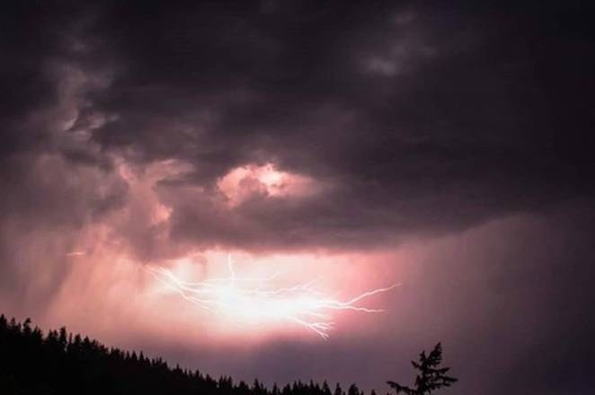
The possibility of a thunderstorm could hit the Okanagan and Shuswap on Wednesday.
Environment Canada is calling for 30 percent chance of showers this afternoon and evening which could bring lightning to the area.
Smoke lingering in the valley is expected to clear by this afternoon; however a special air quality statement remains in effect for the North, Central and South Okanagan as well as the Shuswap.
RELATED: Relief from smoky skies predicted for Okanagan
The smoke is affecting most of the southern half of the province due to wildfires in the region and the northern U.S.
Showers are expected again on Thursday in the region along with another possible thunderstorm.
Temperatures appear to be on a cooling trend for the Okanagan and Shuswap with a high of 32 C in Penticton for Wednesday and a high of 30 C to the north in Salmon Arm.
RELATED: Two lightning sparked fires near the Central Okanagan
In the South Okaganan, Environment Canada is anticipating winds to gust to more than 20 km/hr in the afternoon.
Cooler temperatures and possible thunderstorms are forecasted for the next several days and into the weekend.
@Jen_zee
jen.zielinski@bpdigital.ca
Like us on Facebook and follow us on Twitter.