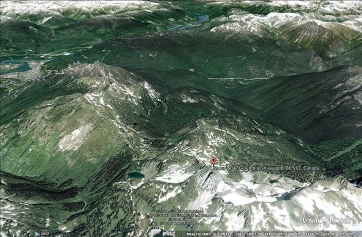
The B.C. Tap Water Alliance, an advocacy group that monitors and strives to protect community water sources in the province, claims Revelstoke’s Greeley Creek watershed and the Dolan Creek watershed that serves as a backup source for the Big Eddy have both lost their protected tenure status.
In a June 4 letter to Revelstoke City Council, BCTWA coordinator Will Koop said the alliance reviewed a provincial list of watershed reserves in May of this year and found that both the Greeley and Dolan watersheds weren’t included.
Koop advises the city to act now: “We would advise the City of Revelstoke to make immediate inquiries with both the Ministry of Lands and the Ministry of Environment about the Reserve status history of Greeley Creek, and to immediately request the government to reinstate or re-register Greeley Creek as either a Section 16 Map Reserve, or as a Section 15 Order-in-Council Reserve, over its hydrographic boundaries in order to protect your vital interests.”
The City of Revelstoke is working on its Greeley Creek Watershed Source Protection Plan, which included a draft report and public consultations in May of this year. However, the report didn’t include the Dolan Creek area.
Koop said the historical reserve status that was enjoyed by both watersheds provided a far superior level of protection than under the proposed watershed protection plan.
In his submission to council, Koop warns that an unprotected watershed is “vulnerable to inadvertent dispositions,” and gave the Revelstoke Adventure Park proposal as an example of a tenure application located within portions of the watershed.
At a public meeting earlier this year, RAP proponent Jason Roe said the project was outside of the Greeley watershed area.
However, the City of Revelstoke seems unsure if it does or doesn’t overlap. In a June 3 referral letter sent to the Columbia–Shuswap Regional District and provincial authorities, the city wants confirmation the proposed development doesn’t overlap the community watershed catchment as it was outlined in a 1973 agreement with the Province of B.C.
In an interview, Koop said he was very sure the reserve status for both watersheds had disappeared over the past 15 years, but couldn’t find a paper trail explaining the context of the removal. He was insistent that city officials would have been in the know if the reserve status had been removed at one point, suggesting the removal the could have come at an in camera meeting.
“For some reason, the tenure status of Greeley Creek as a watershed reserve under the land act has been removed,” he said, listing commercial interests and bureaucratic oversight as possible causes.
He said the reserves have been prone to “shenanigans” and “scandals” across the province.
Koop said the City of Revelstoke has the authority and ability to get to the bottom of what happened to the reserve status.
Since the RAP application became public this spring, the City of Revelstoke has also expressed renewed interest in boundary expansion plans. The city has allocated $25,000 for a feasibility study to extend the city boundary to include the Greeley Creek Watershed east of Mount Mackenzie. In the same June 3 referral letter to the CSRD, the City of Revelstoke requested matching funds from the CSRD and the province to conduct a feasibility study of possible boundary expansion into the area.
In the letter, Mayor David Raven notes the connection between the Greeley Creek watershed and the RAP proposal. “The City’s primary water source intake is on Greeley Creek, adjacent to the proposed development. The City has recently drafted the ‘Greeley Creek Watershed Source Protection Plan,’ which recommends that the development surrounding the watershed, including recreational activities, must be regulated and restrictions on activities that may impact the watershed be enforced.”
At a spring open house looking into the Greeley Creek watershed protection plan, a tenure map showed several skiing tenures in the Greeley area. Some, like the Revelstoke Mountain Resort, overlap the watershed boundary slightly, mainly near the peak of Mount Mackenzie.
When asked by the Times Review, consultants working on the Greeley Creek Source Protection Plan were unaware of the status of a large skiing tenure located within the Greeley Creek watershed – they were unable to name the owner. It was delineated as a ground-skiing operation, as opposed to a heli-skiing tenure, of which several were shown on the map. The consultants were working on discovering its status for the final report.
So, why is Koop stirring the pot? “It’s about me representing that information to the public,” Koop said of his activist role with the B.C. Tap Water Alliance. “It’s entirely possible that this missing status has something to do with this ski hill development.”
But he said the change could have been inadvertent. “I’m open to the possibility that it was a mistake,” he said.
Either way, he believes city officials would have known about the change, and should act now.
If the tenure protecion was purposely removed, wouldn’t it show up in the paperwork? Koop said after extensively researching the matter for an upcoming book on the history of the Dolan Creek watershed and the Big Eddy water system, he’s been unable to find it.
Revelstoke environmental sustainability coordinator Penny Page-Brittin is overseeing the ongoing Greeley Creek watershed protection plan.
“It’s a good question,” Page-Brittin said of Koop’s submission to council. “I haven’t tried to dig down that path as of yet.”
She said she is unsure of the historical background leading to the current protection level covering the watershed. “I don’t think we’re operating as we have this protection,” she said
Page-Brittin added a new cut block went up at the edge of the Greely Creek reserve last year, something that wouldn’t have happened if the area had further protection in place.
“At this time, as best I can see, under Crown land it’s designated as a community watershed,” she said. That’s a different level of protection than the reserve status.
Revelstoke city council was set to consider the Watershed Alliance’s letter at their June 25 meeting.
The Times Review will continue to look into this story, which raises more questions that it answers at this point.
UPDATE: June 27, 2 p.m. The above story was published in the June 26 print edition of the Revelstoke Times Review. What follows is an update following the June 25 council meeting, and an interview with the Revelstoke Adventure Park proponent Jason Roe.
Council to investigate watershed tenure status
At their June 25 meeting, Revelstoke City Council agreed to look into the issue.
"I think the first thing we have to do is some homework to find out exactly where that tenure sits, if at all," Raven said in response to questions from the Times Review. "It may well be that the tenure is still in place and we're not aware of it and he's not aware of it. If it's not, we will endeavour to deal with the agencies to replace that tenure."
The mayor noted the letter came from a private group, not a government agency.
"There's nothing that we've done that would allow it to go," Raven said. He also doubted that previous councils would have actively been involved in removing the tenure. "It would not have been removed by the city. If anything it would have been an administrative slippage [or] oversight."
What about harvesting within the watershed tenure area that has occurred? Would it have been permitted? "Possibly," Raven said, adding some logging is permitted within watersheds.
Following the publication of the initial story, Revelstoke Adventure Park proponent Jason Roe said the City of Revelstoke hasn't been in touch with him about the issue and the watershed tenure.
"We had the province look a the mapping … to make sure we were not in the watershed," Roe explained, saying the none of the proposed adventure park is within the existing watershed boundaries as they've been presented to him.
"You whisper watershed and immediately it becomes a hot button issue," Roe said. "I don't want to be involved in anything that destroys a community watershed."
Since the RAP project was first announced earlier this year, the process emerging from the City of Revelstoke has sent mixed messages.
First, a report from the city's planning department flagged numerous issues, such as vicinity to the watershed, or the inadequate existing bridge crossing of the Illecillewaet River to the proposed park. The report noted possible city boundary expansion into the area.
Put into context, the planning report was a due-diligence list of all potential issues the city may face.
At a subsequent Revelstoke City Council meeting, however, the Times Review asked if boundary expansion into the area was still on the City's agenda.
The answer at that point from Mayor David Raven was "no." Boundary expansion into the Greeley area wasn't being considered, the mayor said. Raven said boundary expansion brought costs and liabilities that the city wasn't prepared to take on.
Just weeks later, however, the June 3 correspondence to the Columbia–Shuswap Regional District – a referral response letter – requested matching funding for a study of City of Revelstoke boundary expansion into the area.
What's clear is the watershed issue, watershed boundaries and process surrounding the Revelstoke Adventure Park application is unclear and unfolding at this point.