Following dry, hot and windy conditions over recent days, Parks Canada fire crews are currently managing two fires within Mount Revelstoke and Glacier national parks.
The “30-Mile” fire in Glacier National Park in the southern end of Beaver Valley is reported to have spread to approximately 600 hectares from its initial size of 30 hectares on Wednesday according to a news release by park fire information officer Shelley Bird.
Parks Canada’s fire management team has used a technique known as aerial ignition, in which they light fires from helicopters, to strengthen natural fire breaks by eliminating fuel in the area in order to slow the fire spread and keep the fire within identified boundaries.
While the Beaver Valley area has been closed for public safety, the release states that the wildfire does not currently pose a risk to people or assets.
As the fire is burning deep in the backcountry, it is not visible from the Trans Canada Highway according to Bird.
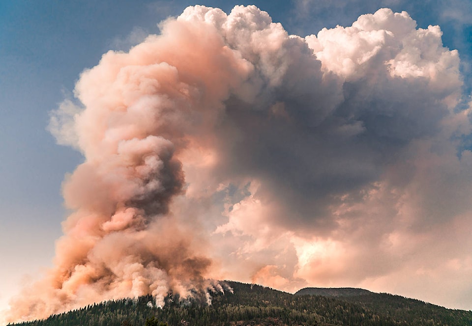
In addition, Parks Canada fire crews are actively managing the Clachnacudainn East wildfire in Mount Revelstoke National Park which remains at approximately 200 hectares in size.
This fire, according to the release, may be visible from the Trans Canada Highway and, along with other fires in the area, could create enough smoke to affect visibility on the highway.
RELATED: Fire in Mt. Revelstoke National Park now 200 hectares
The release also reminds motorists to only stop in designated pull offs or day use areas along the highway.
Both fires were caused by lightning strikes during recent storms, which initially caused five fires with the parks, three of which have since been extinguished.
According to the release, fire crews are monitoring the rest of both Mount Revelstoke and Glacier National parks for new wildfires.
As a result of the two active fires, the Silvertip Canyon climbing area and trail in Mount Revelstoke National Park has been closed along with the Beaver Valley area and trails in Glacier National Park.
To report any new wildfires, illegal campfires, or suspicious smoke within the parks, call Dispatch at 877-852-3100.
RELATED: B.C. wildfires 2018: Fire crews battle blazes across the region
Area fire update
Outside the national parks, 13 fires are currently reported in the Revelstoke area.
According to BC Wildfire Service, the Mount Begbie Shoulder fire which was first reported on July 31, 2018 remains at an estimated size of 0.30 hectares, while the Mulvehill West fire reported August 2 sits at 0.01 hectares.
West of the city, a 48 hectare fire with an approximate location of “North of Mount English” is burning along with a 0.01 hectare fire at Upper Eagle River.
Southeast of Revelstoke, a 100 hectare fire is reported to be active at Akolkolex River, along with three smaller fires at 4.50 hectares, three hectares, and one hectare north of Holyk Creek.
Further south, an active 11 hectare fire is burning at Akololex and a 2.50 hectare fire is burning at McCrae Trail.
North of the city, three fires are burning with sizes of 10.0 hectares at the north end of Downie Loop, 2.10 hectares at Roseberry Mt. West Aspect, and 0.01 hectares at Carns Creek.
All current fires in the area have a suspected cause of lightning at this time.
@NathanKunz1
nathan.kunz@revelstokereview.com
Like us on Facebook and follow us on Twitter.