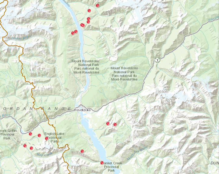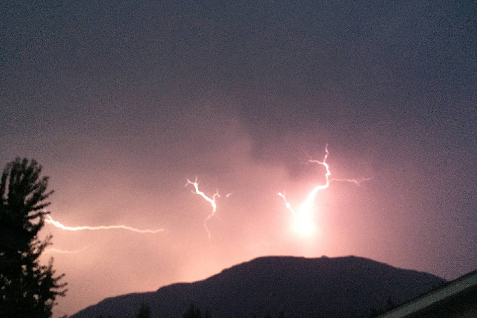
According to the BC Wildfire Service Map there are 17 fires burning in the Revelstoke area following Tuesday night’s thunderstorm.
Currently, a fire on the shoulder of Mount Begbie is being reported at a size of 0.30 hectares.
Another fire, with an approximate location of Montana Bowl on Mount Mackenzie, is reported to be 0.04 hectares.
A third fire, with the approximate location of Mt. Mackenzie Backside was also discovered Wednesday. At the moment it is reported to be 0.01 hectares.
North of the city, seven fires are currently reported to be burning.
Two of the fires have an approximate location of Frisby Ridge with sizes of 0.10 hectares and 0.30 hectares.
Four fires east of Highway 23 are reported as “North of Laforme Creek,” with three holding approximate sizes of 0.01 hectares and the third being estimated at 0.04 hectares.
Further north, two fires are reported at Carnes Creek, with one holding an estimated size of 0.10 hectares and another sitting at 0.01 hectares
West of Revelstoke, there are five active wildfires, with one small fire reported at Three Valley Gap and another located at Upper Eagle River.
In addition, a small fires have been reported at Wap Creek with another on the West slope of Mount English.
The fifth has an approximate location of South Pass Creek.
Adding to the 16 lightning caused fires is one suspected to be human caused burning south of Revelstoke at a size of 0.01 hectares, located one kilometer North of Blanket Creek.
READ MORE: 8 new fires sparked from Shuswap to Revelstoke
Tuesday’s fire near the Ross Lang Cedar Mill is no longer on the Active Wildfires Map.
READ MORE: Small fire burning off highway west of Revelstoke
Parks Canada also sent a news release with updates on the fire activity within Mt. Revelstoke National Park.
On Monday and Tuesday afternoon the fire crews increased active management of the Clachnacudainn Creek East wildfire above the West Welcome area in the park.
“This wildfire was identified as an opportunity to clean up some surface fuels (blow down) and create a fuel break on the slopes of Mount Revelstoke before the on-set of a down trend in weather forecast for later this week,” the release said. “A Parks Canada management team is actively managing the fire within natural boundaries.”
The park remains open and there is no current risk to people or assets, the release continued.
@JDoll_Revy
jocelyn.doll@revelstokereview.com
Like us on Facebook and follow us on Twitter.