Although Revelstoke has been fortunate over the past several years, avoiding the worst of the spring flooding that has affected other areas in B.C., the town does have a small history of big floods.
Last weekend, half the province was put under flood watch after warm weather and rain put the interior at flood risk. One of the worst hit areas was Cache Creek, northeast of Vancouver, which triggered more than 20 evacuation orders for properties in vulnerable areas. It’s been almost 40 years since Revelstoke was hammered with a storm that set the bar for flood preparations. The Revelstoke Review reported on the storm at the time.
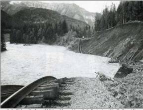
“A blanket of ominous grey clouds socked in the city all day Monday [July 10, 1983] resulting in a record rainfall that eventually blocked C.P. Rail line, closed highway 23 south, the Trans Canada east and flooded the ghost town at Three Valley Gap,” wrote the Review at the time.
The rain lasted 24 hours, dumping more than 50 mm of rain on Revelstoke and the surrounding area.
Paul Tamemoto of the Review at the time wrote about the highway, which was also damaged.
“A ghastly 80 mm of rain over a 24-hour period –Monday to Tuesday afternoon– in the Rogers Pass area casued washouts and slides in seven areas along the Trans Canada,” he said.
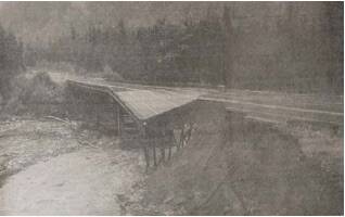
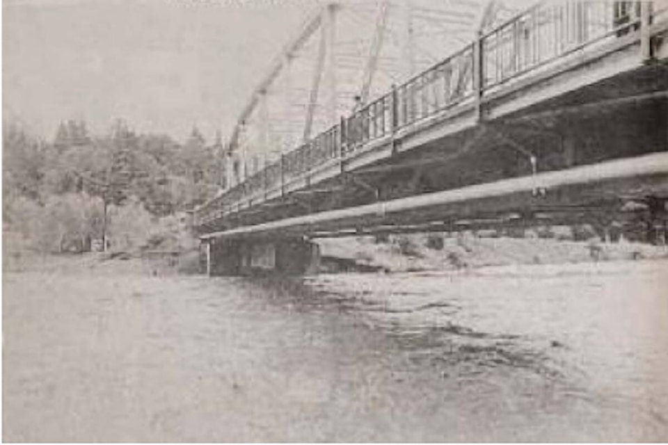
Damage to a bridge on Highway 1 halted traffic between Revelstoke and Golden.
The rain led to a surge of water flowing on the Illecillewaet, raising the speed of the river from an average of 53.1 m3/s to a record-setting flow of 591 m3/s.
Bridge footings were affected, phone lines went down, and mud slides were all part of the fallout of the rain that caused damage around the town.
It’s been nearly 40 years since the 1983 flood, and B.C.’s flood preparations have been updated. Previously, when flood plans were made, they planned for a once in 100-year event. Now, the provincial standard is doubled to a once in 200-year event. With a flow speed of 591 m3/s, the 1983 flood was almost the equivalent of a 200-year event.
Revelstoke’s flood prevention along the Illecillewaet were created after the 1983 flood, which means that the measures in place were established to withstand a 200-year event. The 200-year events have just a 0.5 per cent chance of occurring each year, but the dikes and flood zone maps along the Illecillewaet are set up to withstand those events.
In an assessment conducted by the City of Revelstoke last summer, the dikes in Revelstoke along the Illecillewaet were assessed, proving that they could withstand the 200-year event and not overtop, which happens when water splashes over a dike.
In the assessment, the group contracted by the city to conduct the analysis did highlight the Box Canyon log jam as a potential threat.
READ MORE: The Best of Revelstoke Awards 2023: Food and Drink
@ZacharyDelaney
zach.delaney@revelstokereview.com
Like us on Facebook and follow us on Twitter and subscribe to our daily and subscribe to our daily newsletter.